Delhi-NCR Braces for Rain, Wind and Temp Drop as IMD Issues Yellow Alerts
 Oct, 6 2025
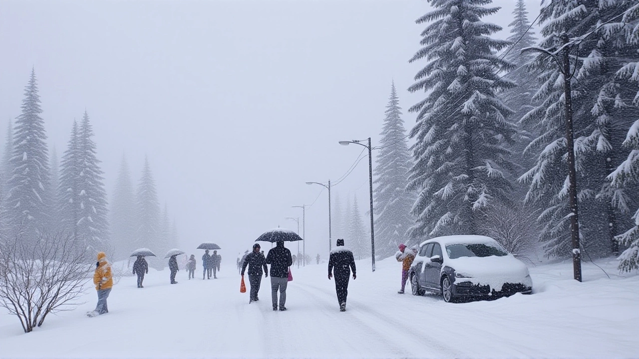
When India Meteorological Department (IMD) rolled out yellow alerts for Delhi and the National Capital Region on October 6‑7, 2025, residents suddenly found their weekend plans under a cloud—literally. A fresh western disturbance churning in the northwest is set to dump light‑to‑moderate rain, unleash thunderclaps and gusts that will flirt with 50 km/h, and pull the mercury down by as much as six degrees. Why it matters? The temperature dip makes this the sharpest fall of the season, while the rain totals could rewrite October’s climate record for the capital.
What’s Driving the Sudden Shift?
Early‑morning fog on October 4 coated parts of Noida, Ghaziabad and Gurgaon, a classic sign that cooler air is squeezing in from the north‑west. The culprit is a fast‑moving western disturbance—a low‑pressure system that gathers moisture over the Arabian Sea and the Bay of Bengal before slamming into the Indian subcontinent. Unlike the monsoon, this system is dry at its core but carries enough humidity to trigger showers and scattered thunderstorms.
“We’re seeing a classic post‑monsoon pattern where the jet stream nudges a disturbance into the sub‑continent,” explained Dr. Anil Kumar, senior meteorologist at IMD’s regional office. “The wind field will shift to north‑westerly, pushing cooler air over Delhi while the moisture influx fuels brief but intense rain bouts.”
Day‑by‑Day Forecast (October 4‑8)
- October 4 (Saturday): Mostly cloudy with isolated showers. Max 33 °C, min 24 °C. Wind 20‑30 km/h.
- October 5 (Sunday): Light rain in the evening, occasional thunder. Max 34.1 °C (peak of the week), min 24.2 °C. Wind ramps up to 30 km/h.
- October 6 (Monday) – yellow alert: Widespread rain across Delhi‑NCR, thunderstorms after 18:00, gusts hitting 50 km/h. Max 31‑33 °C, min 23‑25 °C. This is the day IMD expects the sharpest temperature drop.
- October 7 (Tuesday) – yellow alert: Similar pattern to the 6th, but showers become intermittent. Max 30‑32 °C, min 22‑24 °C. Wind stays breezy, 30‑40 km/h.
- October 8 (Wednesday): Partly cloudy, rain retreats. Max 28‑30 °C, min 20 °C. Light winds, 15‑20 km/h.
Temperatures will swing between a high of 34 °C on the 5th and a low around 20 °C by the 8th—an unseasonal swing that catches many off guard.
Rainfall Records and Historical Context
The capital’s baseline for October is a modest 15.1 mm. Yet Safdarjung weather station logged 51.8 mm in just the first five days of 2025—more than three times the norm. By comparison, the same stretch in 2024 recorded zero measurable rain.
If IMD’s projections hold and rainfall continues at the current pace, the month could close near the 100 mm mark. That would place October 2025 among the wettest on record, edging out the previous high of 92 mm set in 2010. Such a deluge is unusual because the monsoon retreats in late September, and the city typically enjoys clear skies and mild evenings in early October.

Impact on Residents, Transport and Services
City officials have already warned commuters to expect delays on the Delhi Metro and on major arterial roads such as the Delhi‑Gurgaon Expressway. “We’re deploying additional sandbags near low‑lying areas and urging residents to keep windows closed during thunderstorms,” said a spokesperson from the Delhi Municipal Corporation.
Air quality, which has hovered around the “moderate” category this month, may see a brief improvement as rain washes away particulate matter. However, the gusty winds could trigger localized dust storms in peripheral zones, especially where construction sites are active.
Business owners are scrambling to protect outdoor merchandise—wet markets in Old Delhi reported a 15 % drop in footfall on Monday, as shoppers opted to stay indoors. On the flip side, cafés near Connaught Place saw a surge in customers seeking a warm beverage after the first heavy showers.
Looking Ahead: What to Expect After the Storm
By October 9, IMD expects the western disturbance to move eastward toward the Himalayas, lifting the rain and allowing temperatures to settle between 28 °C and 30 °C during the day and a comfortable 20 °C at night. The city’s water reservoirs—particularly the Upper and Lower Ganga canals—could benefit from the unexpected boost, easing concerns ahead of the winter months.
In the longer term, climatologists note that such post‑monsoon rain spikes may become more frequent as climate change alters jet‑stream patterns. “We’re tracking a trend where western disturbances intensify and linger longer over northern India,” said Dr. Priya Singh, climate researcher at the Indian Institute of Tropical Meteorology. “Policymakers need to consider this when updating urban drainage and heat‑wave preparedness plans.”
Frequently Asked Questions
How will the yellow alerts affect daily commuting in Delhi?
Commuters should expect slower traffic on major highways and possible delays on the Delhi Metro, especially on elevated sections exposed to wind. Authorities have advised planning extra travel time and checking real‑time updates from the Delhi Traffic Police.
What is a western disturbance and why does it cause rain in Delhi?
A western disturbance is a low‑pressure system that forms over the Mediterranean or the Atlantic and moves eastward, picking up moisture from the Arabian Sea and the Bay of Bengal. When it reaches the Indian subcontinent, the cooler air it carries meets warm, humid air over the plains, triggering showers and thunderstorms.
Is the rainfall this October unusual compared to previous years?
Yes. By October 5, the city had already logged 51.8 mm of rain—more than three times the historical October average of 15.1 mm. If the current trend continues, the month could finish near 100 mm, making it one of the wettest Octobers on record for Delhi.
Will the rain improve Delhi’s air quality?
Short‑term, yes. Rain tends to wash particulate matter from the atmosphere, providing a temporary dip in PM2.5 levels. However, gusty winds could stir up dust in certain neighborhoods, offsetting some of the benefit.
What should residents do to prepare for the gusty winds?
Secure loose objects such as garden furniture, close windows, and avoid venturing out during the peak thunderstorm hours in the evening. The municipal corporation has also set up emergency hotlines for reporting fallen trees or power line incidents.