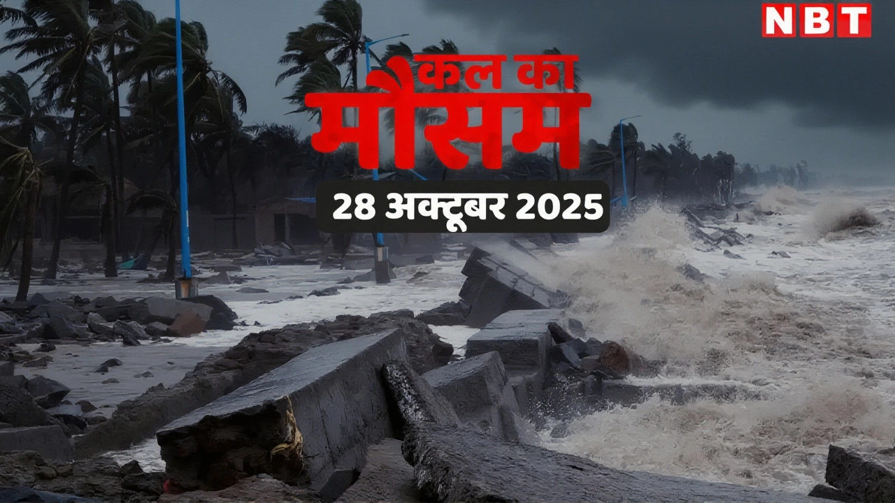
Cyclone Montha Heads for Andhra Coast: 110 km/h Gusts Expected as Evacuations Begin
 Oct, 28 2025
As Cyclone Montha churns toward India’s eastern seaboard, coastal communities from Kakinada to Visakhapatnam are bracing for a violent encounter. With sustained winds already at 85 km/h and gusts threatening to hit 110 km/h, the storm is forecast to make landfall near Kakinada on the evening of October 28, 2025—a timeline that has turned emergency response into a race against time. The India Meteorological Department (IMD) confirmed the cyclone intensified from a deep depression just before midnight on October 26, and despite wind shear and dry air creeping in, it’s holding its strength with eerie determination. This isn’t just another storm. It’s the kind that rewrites calendars, empties homes, and leaves behind stories whispered in the wind.
Emergency Mobilization Across Two States
In Andhra Pradesh, Chief Minister N Chandrababu Naidu and his son, Minister Nara Lokesh, have turned the state’s Real-Time Governance Society (RTGS) war room into a 24/7 nerve center. Over 400 relief camps have been set up in East Godavari, West Godavari, Krishna, Guntur, and Prakasam districts. Fifteen squads of the National Disaster Response Force (NDRF) and dozens of State Disaster Response Force (SDRF) personnel are deployed—some already on rooftops, others in boats, ready to pull people from flooded streets. Meanwhile, in Odisha, Revenue and Disaster Management Minister Suresh Pujari announced the evacuation of nearly 100,000 people from eight southern districts marked as Red Zones: Malkangiri, Koraput, Rayagada, Ganjam, Gajapati, Kandhamal, Kalahandi, and Nabarangpur. All schools, anganwadi centers, and colleges in Gajapati district will remain shut until October 30. “We’re not waiting for the storm to knock down our doors,” Pujari said. “We’re knocking on theirs first.”What the Forecast Doesn’t Say Out Loud
The Joint Typhoon Warning Center (JTWC) and IMD agree on the track: north-northwest, steady, relentless. But behind the numbers—85 km/h winds, 5.5-meter waves, 36-hour dissipation timeline—is a quieter truth. Cyclone Montha is forming in a region where the Bay of Bengal has warmed faster than almost anywhere else on Earth. Sea surface temperatures near 30°C are giving storms like this more fuel than they’ve had in decades. And while models show strong consensus on the path, they can’t predict how much rain will fall in a single hour—or whether a school in Prakasam will lose its roof before the evacuation buses arrive. Coastal Chennai, which had been drenched since Saturday, got a brief reprieve Monday afternoon as the storm’s outer bands shifted north. But Director Senthamarai Kannan of the Regional Meteorological Centre warned: “The calm before the storm isn’t calm at all—it’s the sound of a thousand doors being nailed shut.”The Human Cost in Numbers
- 400+ relief camps established in Andhra Pradesh- 128 disaster response teams deployed in Odisha
- 100,000+ people evacuated across both states
- 5.5 meters (18 feet) maximum wave height recorded
- 85 km/h sustained winds as of October 27, 11:30 a.m.
- 90–100 km/h expected at landfall on October 28 evening
- 110 km/h peak gusts possible
- October 25–29: Total ban on fishing in the Bay of Bengal South Central Railway canceled unspecified trains along the Chennai-Kolkata corridor. Fishermen, who’ve seen cyclones come and go for generations, are now being told not to go out—not even for a quick check. “We used to say, ‘The sea gives, the sea takes,’” said veteran fisherman Ramesh K. from Kakinada. “Now, we just say: ‘Don’t go.’”
What Comes After the Winds Die Down
Once Cyclone Montha makes landfall, it’s expected to slow, dump torrential rain over southern Odisha, and begin its slow fade—dissipating within 36 hours. But the real damage won’t be measured in wind speed. It’ll be in the number of homes without power, the schools that can’t reopen, the roads washed away between Machilipatnam and Narasapur. The European Civil Protection and Humanitarian Aid Operations (ECHO) is monitoring closely, though no international aid has been requested yet. IMD Director General Mrutyunjay Mohapatra emphasized that while the storm’s intensity is concerning, preparedness has improved dramatically since 2013’s Cyclone Phailin. “We’ve learned from past tragedies,” he said. “But nature doesn’t care what we’ve learned.”What’s Next?
The next 24 hours are critical. If the storm strengthens just 10% more before landfall, it could push into “severe cyclonic storm” territory—meaning structural damage to concrete buildings becomes likely. Emergency teams are now focusing on high-risk zones: low-lying villages near the Godavari delta, fishing hamlets with no elevated shelters, and informal settlements built on reclaimed land. By Wednesday, as the skies clear, the real work begins: assessing crop losses in Krishna district, restoring power lines snapped by falling trees, and rebuilding trust in a system that told people to leave—then had to scramble to feed them.Frequently Asked Questions
How many people are at immediate risk from Cyclone Montha?
Over 100,000 people have been evacuated from eight Red Zone districts in Odisha and five coastal districts in Andhra Pradesh. But an estimated 2.5 million live within 20 kilometers of the projected landfall zone. Many in informal settlements or remote fishing villages may not have reached camps yet, making real-time tracking critical.
Why is Cyclone Montha holding strength despite unfavorable conditions?
Even with wind shear above 55 km/h and dry air intrusion, the storm is drawing energy from unusually warm sea surface temperatures—near 30°C in the Bay of Bengal. This warming trend, linked to climate change, is giving cyclones more fuel to resist weakening. Models show Montha’s core remains tightly organized, which helps it maintain intensity longer than expected.
What makes this cyclone different from past ones like Phailin or Fani?
Unlike Phailin (2013), which hit Odisha directly, Montha’s landfall is closer to Kakinada—a region less prepared for major cyclones. Unlike Fani (2019), which had a longer lead time, Montha intensified rapidly in just 36 hours. The speed of development, combined with its track over densely populated coastal zones, increases the risk of surprise impacts.
Are schools and hospitals ready for the storm?
In Odisha, all schools and anganwadi centers in Gajapati and neighboring districts are closed until October 30. Many have been converted into temporary shelters with stocked food, water, and medical kits. In Andhra Pradesh, district hospitals are on high alert, with backup generators and emergency blood supplies ready. But rural clinics—especially those without concrete roofs—remain vulnerable.
What’s the risk of flooding after landfall?
Heavy to very heavy rainfall—up to 200 mm in 24 hours—is expected along the coast. The Godavari and Krishna river basins are already saturated. If the storm stalls after landfall, as some models suggest, inland flooding could be severe. Authorities are monitoring reservoir levels in Srisailam and Nagarjuna Sagar dams, which could require controlled releases.
Will international aid be needed?
So far, neither Andhra Pradesh nor Odisha has requested international assistance. India’s National Disaster Response Force and state teams are well-equipped, and the central government has pre-positioned supplies. However, if infrastructure damage is widespread—especially to roads and power grids—foreign aid may be sought within 48 hours post-landfall, as per ECHO’s contingency protocols.